Updated Post — Feb. 22, 2021, 11:30 a.m.
The avalanche danger for downtown Juneau was lowered from “high” to “considerable” on Monday. But the city’s avalanche forecaster says the risk could go back up again if temperatures rise higher than expected.
Emergency programs manager Tom Mattice wrote in his daily urban avalanche advisory on Monday that natural slides are still possible in downtown Juneau. Human triggered slides remain more than likely.
Mattice said there were slides observed over the weekend on the White Path, the furthest north avalanche path off of Mount Juneau. No slides have come down above the Behrends Neighborhood. He wrote there has not been a lot of slide activity there this season and wrote that “we have a great deal of snow up there now.”
He advises residents to limit their time in Behrends Neighborhood and to avoid the Flume Trail.
Meanwhile, the state Department of Transportation & Public Facilities says they plan to do avalanche hazard reduction above Thane Road on Tuesday between 10:00 a.m. and noon. Thane Road will be closed during that period. If any avalanche debris covers the roadway, then the road will remain closed until heavy equipment can clear the snow.
Original Post — Feb. 21, 2021, 11:30 a.m.
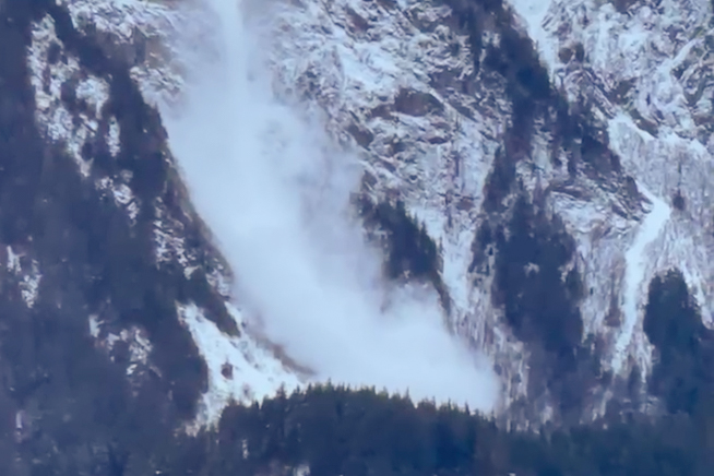
Juneau’s avalanche danger is high this weekend, which means human-triggered avalanches are very likely. And emergency officials say that when avalanches do happen, they’re likely to be large.
Emergency Programs Manager Tom Mattice issued a warning to avoid the Flume Trail and the area beyond the gate on the Behrends Avalanche Path near downtown.
“Even limiting time spent in the Behrends neighborhood is probably a good idea today with the potential size of the avalanches,” Mattice wrote in an urban avalanche advisory.
In that advisory, Matttice pointed to the strong storm activity Juneau has had for the last several days. The Eaglecrest Ski Area has seen about 20 inches of snow over the last three days. And daily winds have peaked at 90 miles an hour throughout the region.
That combination of high snow loads and high winds puts a lot of pressure on previous weak layers of snow.
“We have seen multiple natural avalanches around the region over the last 2 days,” Mattice wrote.
The National Weather Service currently has Juneau under a winter weather advisory until 9 a.m. Monday. Sunday morning, there is a light rain but it’s expected to turn into snow showers later in the day and into the evening.
That will add to the snow load and Mattice wrote that one big issue is the weak snowpack structure in the Juneau area.
On Saturday, when they tested the stability of the snow layers, Mattice wrote that it didn’t take much pressure for the snow layers to crumble.
One concern is that a slide triggered on the weak layers at the top of the snowpack might spread to the deeper weak layers at the bottom, he wrote.
In a message on Saturday, the Alaska Department of Transportation & Public Facilities said that there is also an avalanche hazard above Thane Road. They warned people not to stop or park in the avalanche danger zone — which are marked by warning signs.
They also warned that Thane residents should be ready for extended road closures.