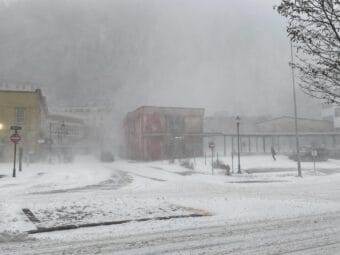
Alaskans shouldn’t read too much into the early season cold temperatures and snowfall.
So says National Weather Service climate researcher Brian Brettschneider, back for our Ask a Climatologist segment.
Rather, he says, there are better longer-term indications that there’ll be a colder-than-normal winter in Alaska, with another La Niña pattern.
Even so, as for whether it’ll be chilly and snowy, Brettschneider says we’ll still just have to wait and see.
Listen here:
The following transcript has been lightly edited for clarity.
Brian Brettschneider: So if you look at some of the automated stations, we call this SNOTEL network, which is generally, say 1,000 to over 3,000 feet in elevation, they’re having perhaps their best early season snowfall in the entire period of record, which in some cases is about 30 years. It can be tempting to kind of extrapolate that and say, “Oh, this is going to be a really good snow winter,” to kind of connect some dots, some dots that may not actually exist. So we do need to be really careful when we extrapolate what’s happened early in the season to the rest of the season.
Casey Grove: Temper your expectations.
Brian Brettschneider: There you go.
Casey Grove: Brian, let’s go way up north and talk about sea ice. What is the sea ice doing? And I mean, what has it been doing here over the last few months?
Brian Brettschneider: So looking over a number of decades, and then including oral records going back over 100 years, this summer was a very, very poor sea ice summer in the Chukchi and Beaufort seas. But it was probably the best in the last 15 years. And so that is going to give us a little bit of a head start easing into the cold season at a faster pace than we have in recent memory.
Casey Grove: And when you say head start, you mean like the ice has been forming earlier than in recent years?
Brian Brettschneider: Right, so when we look at the the progression of sea ice, we generally are watching it move from north to south. And then we’ll see it start to form in place, you know, along the immediate coast and in bays and so on. But the bulk of the pack ice has got to start from somewhere. So it starts at whatever was left over from the summer melt season. So this summer melt season, there was a lot more ice that was left behind closer to Alaska. It quite literally has less distance to travel before it makes its way to the coast.
Casey Grove: Gotcha. OK, so what are we looking at this winter? I mean, the state is obviously a big one and it can be different, but what are we thinking about for this winter in terms of predictions across the state?
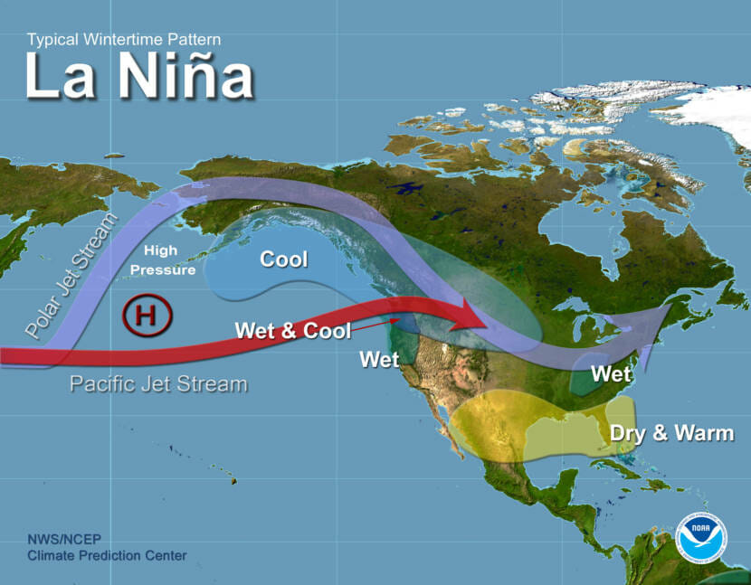
Brian Brettschneider: Well, if you remember last winter was a La Niña winter, and generally La Niña winters are cooler and drier than normal across a fairly large part of the state. Last winter didn’t really work out that well in terms of matching historical La Niña winters. Even though maybe it felt cold for parts of the winter, it was actually kind of above normal in most of the state and especially in Southwest Alaska. That being said, you know, going into a second La Niña winter in a row, again, our expectation is, if we have a typical La Niña, that it’s going to be cooler than normal across a sizable portion of the mainland, with the coolest being perhaps in Southcentral and Southeast, and then drier than normal in most of the state, except for maybe the Southwest and the Bering Sea coast.
Casey Grove: What is it that climate researchers look at when they make these predictions?
Brian Brettschneider: Well, you know, when we’re looking at La Niña, what we’re looking at is the patterns of sea surface temperatures. And the sea surface is a major driver of tropical convection, which is a major driver in global circulation patterns by shifting where those big tropical thunderstorms form. And when those form it moves air literally up and vertically and horizontally, affecting the entire global circulation system.


