Suicide Basin, a glacial lake tucked behind the Mendenhall Glacier, is a looming flood threat for Juneau residents this time of year.
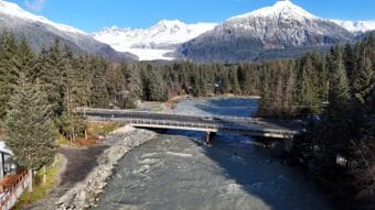
Glacial outburst floods or jökulhlaups have happened in the Mendenhall River every year for the last decade. The basin fills up with rain and meltwater throughout the summer until it drains downstream.
Last year’s flooding was catastrophic. As the basin fills again, scientists at the University of Alaska Southeast are keeping a close eye on it. KTOO’s Anna Canny sat down with one of them.
This interview has been edited for length and clarity.
Anna Canny: I guess maybe you could start by introducing yourself and telling me a little bit about your background and what brought you to Juneau this summer.
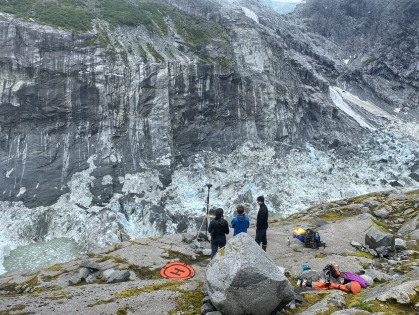
David Polashenski: Absolutely. My name is David Polashenski, and I’m a postdoctoral researcher here at the University of Alaska Southeast. Just started the position a couple of months ago after finishing my PhD up in Fairbanks at University of Alaska. And yeah, my background is in ice dynamics and glaciology. So Eran Hood here hired me on to try to help with the Suicide Basin monitoring project this summer. I would say mostly I’ve kind of continued the monitoring work that UAS, the USGS and the National Weather Service do together as a partnership for the past several years. So this summer, we’ve gone up to the basin now three times and conducted three drone surveys. So when we go up there, we just have a small little quadcopter drone with a camera on it. And we have it fly a regular flight path, so it’s basically just like mowing the lawn back and forth on the glacier, taking pictures looking down. And each picture has overlap with the previous, so that allows you to stitch all 2,000 or so pictures from any given survey into one big image of the entire basin. And then using digital image processing, you can turn that into an elevation map so you can keep track of how the basin’s shape is changing through time, and how the water level is rising up and down.
Anna Canny: So you talked about you’re basically figuring out the shape of the basin. How much is that changing from survey to survey?
David Polashenski: Yeah, so like for this summer, it’s not changing a ton, but year to year, it’s changing slowly but surely. Kind of there’s these two competing feedbacks for how much water the basin can hold. The Mendenhall Glacier itself acts as a dam, and over time as the Mendenhall lowers, the dam’s elevation gets lower, and so that means you can hold less water behind the dam as the ice melts away, essentially. But then there’s the competing feedback of as the Mendenhall Glacier pulls back out further into its main branch, then the surface area of this basin increases over time. So I was looking at it this morning, I believe that the basin has dropped on the order of tens of feet over the past couple of years, as far as the ice dam elevation, but it’s also expanding out into the main branch so that you have these competing feedbacks. And it’s not clear which one’s winning at the moment.
Anna Canny: Right, it’s getting shallower in some ways, but also wider?
David Polashenski: Exactly.
Anna Canny: And then figuring out those competing factors helps you narrow in basically on how much water it can hold and therefore how much water it could release?
David Polashenski: Right. So are the monitoring efforts that we’re trying to keep track of is there’s basically two things we’re concerned about is how much water is in the basin? And then the million dollar question, that’s actually much harder is, how quickly is it going to drain? So how big is your bathtub and what size pipe is coming out the bottom of it, essentially, control the dynamics of this flood event. And we’re getting better estimates of total volume over the years, especially after the big flood event last, we were able to do a drone survey when the water level was very, very low. So that gave us the baseline topography of the basin, which we just hadn’t seen before, because the water level had never dropped that low before. The two really big time periods that’s really important to get an elevation map is kind of right now when we’re approaching the maximum water level. And then after the flood event, as soon as we can get it back up there, we want to resurvey the whole basin to get again, this highest water level to the lowest water level survey allows us to estimate the total volume.
Anna Canny: Well, you mentioned we’re getting close to that maximum volume. When’s the last time you were up there and what did you see?
David Polashenski: Yeah, we were up there exactly a week ago, last Thursday. And I would have to look to double-check, but I believe the water level was about 402 meters. And so it is lower water elevation than then last summer, but still rapidly filling. As of this morning when I checked the monitoring website, it was about 410 meters. So we have got about, you know, 10 or 15 meters more to go to be at a similar water elevation to last summer.
Anna Canny: Okay. And I mean, it’s not always that it fills up and then it drains like clockwork. There’s been some years where it’s drained before it’s all the way full, right?
David Polashenski: Yes, exactly. So, this has been going on now since 2011. And sometimes, like last year, it drains catastrophically and almost fully, but then another year it only drains you know, a partial release. So 20%, 40% of the basin. And so that’s really the million dollar question: how much of the total volume is going to come out when it begins to drain? Weather and helicopter logistics willing, we’re hoping to go up again sometime in the next few days. And then once the basin drains later, you know, days or weeks from now, I would encourage everyone to keep an eye on the website for if and when the drainage does start occurring. The National Weather Service will publish a flood forecast.


